This circuit is ideal for discovering the former Commune of Chénerilles (today attached to Malijai). Its scattered farms and its now ruined village are typical of the Haute-Provence of yesteryear.
Route details
Description
Departure from Malijai, road D8 towards Le Chaffault, 1km from the village. The circuit starts in a bend in the D8, at Combe Obscure. After a fairly easy climb to Les Bertrands (large restored farm), you join the D12 which links Malijai to Puimichel.
Follow this road on your left for 30m, then find, on your right, the marked path which rises in the middle of the woods of white oaks, service trees and maples.
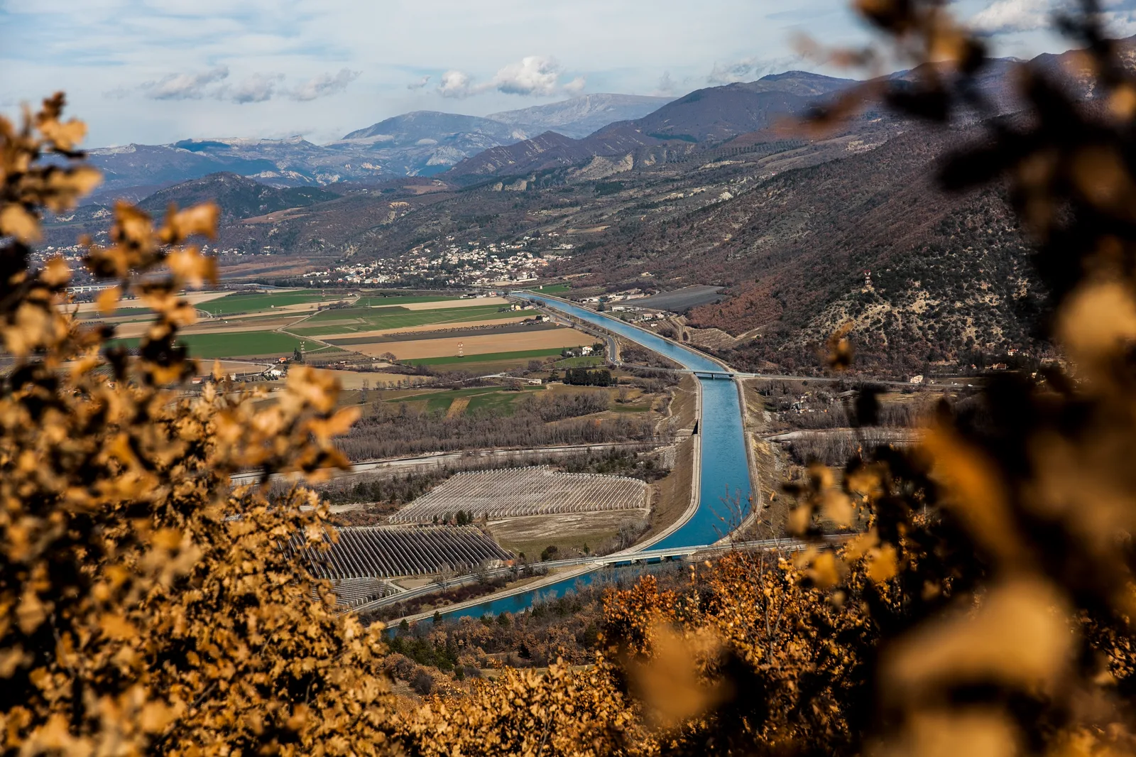
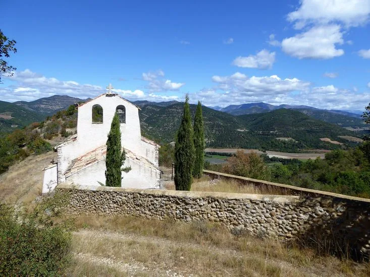
When you arrive at the plateau, take the track on your left. (From the right you reach Malijai via the Chemins de Puimichel or the Penitents des Mées.) After having rejoined and followed the road for 500m, take the tarmac path on the left along the edge of the Puimichel plateau. The view then extends widely to the South and East over beautiful red lands, cultivated with cereals and lavender. The path quickly goes back down on your left. After passing near a farm, reach the chapel and the ruins of the village of Chénerilles, almost always following a hillside path overlooking the Bléone valley.
As incredible as it may seem, these arid and stony lands made up most of the village's agricultural land! After this, the descent is quite steep and slippery until you reach the D8 road which, in 2km, brings you back to your starting point.
Be an actor in the quality of your practice sites:
Suricate allows you to report the problems you encounter when you practice. To allow you to make the most of the marked and maintained trails in the department, we ask that you report any anomalies observed during your outdoor activities by using the national website. meerkat.
Follow this road on your left for 30m, then find, on your right, the marked path which rises in the middle of the woods of white oaks, service trees and maples.
When you arrive at the plateau, take the track on your left. (From the right you reach Malijai via the Chemins de Puimichel or the Penitents des Mées.) After having rejoined and followed the road for 500m, take the tarmac path on the left along the edge of the Puimichel plateau. The view then extends widely to the South and East over beautiful red lands, cultivated with cereals and lavender. The path quickly goes back down on your left. After passing near a farm, reach the chapel and the ruins of the village of Chénerilles, almost always following a hillside path overlooking the Bléone valley.
As incredible as it may seem, these arid and stony lands made up most of the village's agricultural land! After this, the descent is quite steep and slippery until you reach the D8 road which, in 2km, brings you back to your starting point.
Be an actor in the quality of your practice sites:
Suricate allows you to report the problems you encounter when you practice. To allow you to make the most of the marked and maintained trails in the department, we ask that you report any anomalies observed during your outdoor activities by using the national website. meerkat.